Liberty County was created on December 15, 1855, from part of Gadsden County, and Bristol is its county seat. A university map site says its name honors liberty, one of the ideals on which the United States was founded. The county is home to Torreya State Park, named for a rare tree found on the Apalachicola River bluffs. People lived at the Yon site, in the middle part of the Apalachicola River valley, as early as about A.D. 320.
This page tells the story in order, from the first people on the Apalachicola River to a holiday train, a park reopened and two National Register milestones, then lists places in the county where you can still see it. The sources for each part are named at the end of that part, and all of them are listed at the bottom of the page.
The first people on the river
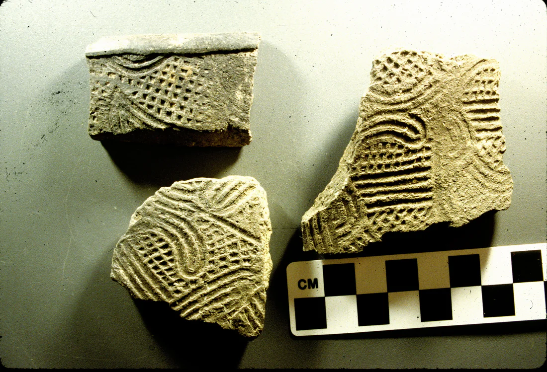
Archaeologists have called the Apalachicola River "prehistoric Highway 1." Native Americans traveled it between the Georgia mountains and the Gulf of Mexico. Between A.D. 200 and 900, Native Americans built three dozen or more mounds on ground above the river's floods. From A.D. 900 to 1500, thousands of people of what archaeologists call the Fort Walton culture farmed corn and other crops in the region.
The Yon Mound and Village Site lies in the middle part of the Apalachicola River valley, in the Bristol area. A very small Swift Creek group lived there around A.D. 320. Around A.D. 1200 the site grew quickly into a Fort Walton center, with its first mound and its first busy village. Clarence Bloomfield Moore first recorded the site around 1900.
Sources: Historical Marker Database: The Apalachicola River, A Florida Blueway (Chattahoochee River Landing Park marker); Florida Natural Areas Inventory: ARROW History Regional Timeline, Apalachicola Region; University of South Florida Digital Commons: The Archaeology of Yon Mound and Village, Middle Apalachicola River Valley, Northwest Florida (Jeffrey Patrick Du Vernay, 2011); National Park Service, NPGallery: Yon Mound and Village Site
Next: Chapter 2, Spanish explorers, Creek towns and Jackson's army →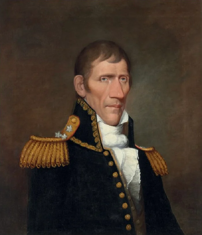
Spanish explorers, Creek towns and Jackson's army
In 1528 the Spanish explorer Panfilo de Narvaez and his small army passed through the region. Donald E. Shepard has proposed a route on which his men crossed a large stream they named the Magdelena, the river now called the Apalachicola. In 1539 Hernando de Soto led his men through Florida and on into Georgia. In the 1600s the Spanish founded four missions among the Indians of the Apalachicola area, two of them along the river. In 1745 Creek people led by Secoffee, a son of Brim, built towns in the area.
In 1815 a British commander moved his troops, along with his Indian and Black allies, to Prospect Bluff on the Apalachicola River. On July 27, 1816, Colonel Duncan Clinch led a ground force, backed by two gunboats, in an attack on the fort there. In 1818 General Andrew Jackson marched south on the east bank of the river to the site of that fort, which the Florida Natural Areas Inventory (FNAI) calls the British Negro Fort. There he had his aide James Gadsden build a new fort. The Torreya State Park brochure notes that Jackson crossed the river with his army.
Sources: Florida Natural Areas Inventory: ARROW History Regional Timeline, Apalachicola Region; Florida State Parks: Torreya State Park brochure
Next: Chapter 3, A road, steamboats and a rare tree →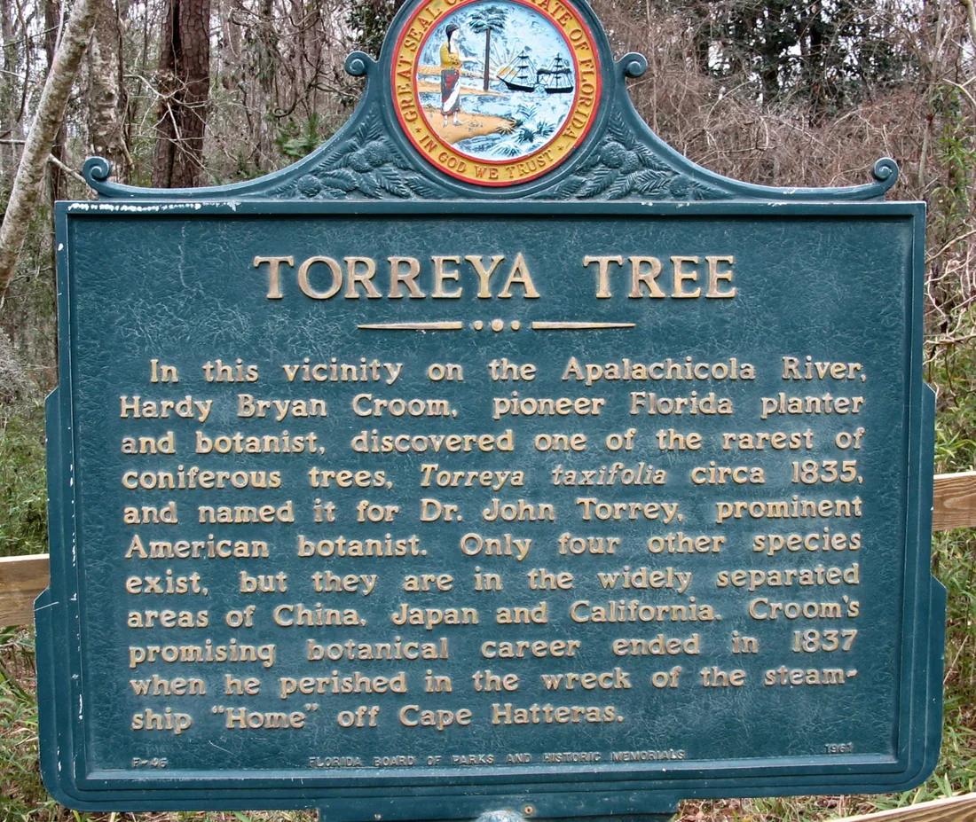
A road, steamboats and a rare tree
The Torreya State Park brochure says the first government road across north Florida, built in 1828, met the Apalachicola at what is now the park. That same year the steamboat Fannie Fearn's began trips between the Gulf and Columbus, Georgia. In all, more than 200 steamboats worked the Apalachicola River, the brochure says.
Around 1835 Hardy Bryan Croom, a planter and botanist, found the Florida torreya tree in what is now Torreya State Park. The tree's name honors Dr. John Torrey, a leading American botanist. The historical marker for the tree calls it one of the rarest cone-bearing trees. It says the only other torreya species grow far away, in China, Japan and California. Florida State Parks estimates that the Apalachicola River valley held 600,000 torreya trees in the early 1800s.
Croom died in 1837 when the steamship Home was wrecked off Cape Hatteras. Around 1849 the planter Jason Gregory built a house at Ocheesee Landing, across the river from the bluff where the house stands today.
Sources: Florida State Parks: Torreya State Park brochure; Florida Natural Areas Inventory: ARROW History Regional Timeline, Apalachicola Region; Florida State Parks: Torreya State Park; Historical Marker Database: Torreya Tree (Florida Board of Parks and Historic Memorials marker F-46, 1961); Florida State Parks: The Rare Florida Torreya Tree
Next: Chapter 4, A new county named Liberty →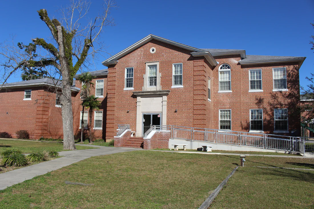
A new county named Liberty
Liberty County was formed on December 15, 1855, from part of Gadsden County. A University of South Florida map site says the name Liberty honors one of the ideals on which the United States was founded. An older WPA history says the name reflected the public feeling of the county's people.
The same history says the county's first village, Riddleysville, sat beside the Apalachicola River. It took its name from a man called Riddleys, who was the first to settle there and set up a rough distillery. Bristol, settled in 1859, became the county seat. Moses Strause, a pioneer settler, gave the county the land where a small log courthouse was first built. The WPA history lists R. F. Hosford as the first county judge.
Also in 1859, Emmanuel Sykes founded Coe's Mill near Big Creek. The Coe family gave the town its name.
Sources: University of South Florida, Florida Center for Instructional Technology: FL Maps, Liberty County; Florida Memory, State Archives of Florida: History of Liberty County (WPA); Florida Natural Areas Inventory: ARROW, History: Liberty County
Next: Chapter 5, Plantations, slavery and the Civil War →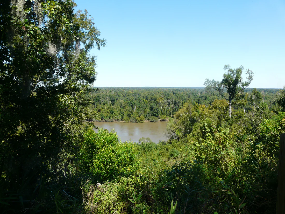
Plantations, slavery and the Civil War
In 1856 James C. Evans paid more in taxes than anyone else in Liberty County. He held 71 people in slavery on a large plantation near what is now Bristol. Rock Bluff, a small river town on the Apalachicola, was settled in 1857. It came to have several schools and country stores, and its postmistress, Mrs. N. Jackson, was related to President Andrew Jackson. Before the Civil War a cotton warehouse stood at Rock Bluff Landing.
A 1971 National Register form says Confederate guns were set on the high bluffs of the east bank, across the river from the Gregory house, to stop Union gunboats. Battery Bluff, also called Neal's Bluff, holds the sites of six Confederate gun pits. The form says this far-off corner of the war saw little of its violence. Once the war ended and slavery was abolished, the Gregory plantation went into decline. When the people Evans had enslaved were freed, he lost his fortune and died in poverty.
Sources: Florida Natural Areas Inventory: ARROW, History: Liberty County; Florida State Parks: Torreya State Park, History; National Park Service, NPGallery: National Register of Historic Places Inventory, Nomination Form, Torreya State Park (Gregory House), 1971; Florida State Parks: Torreya State Park brochure
Next: Chapter 6, Pine woods, river mail and a newspaper →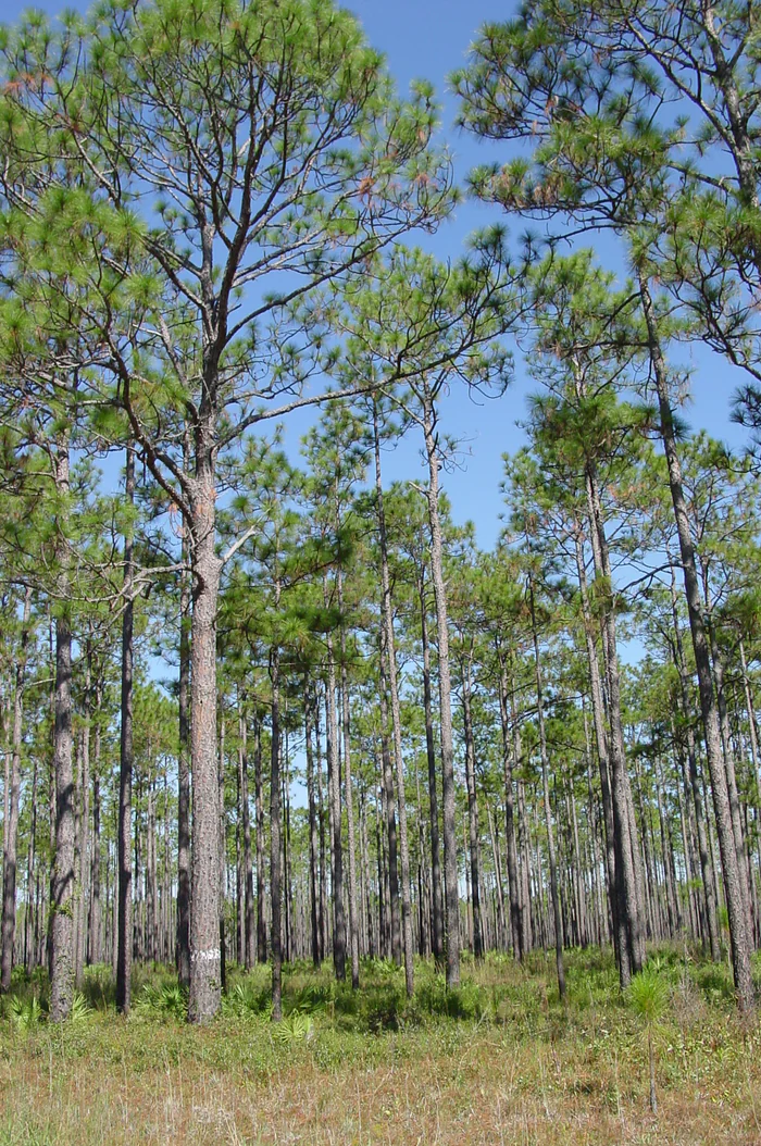
Pine woods, river mail and a newspaper
The WPA history describes a county covered with pine woods. It says raising livestock was the county's main industry and that cotton and grain grew well. Mail came in by boat on Mondays and Thursdays, on a run from Columbus, Georgia, to Apalachicola. An FNAI timeline says Bristol depended on steamboat traffic to make a living.
In 1885 Lake Mystic was founded with a hotel, a school, three churches, a post office and a gristmill. It had 75 people at the time. FNAI says the county's first printing press arrived in 1897, and George C. Williams used it to put out his paper, the Liberty County Observer.
Sources: Florida Memory, State Archives of Florida: History of Liberty County (WPA); Florida Natural Areas Inventory: ARROW History Regional Timeline, Apalachicola Region; Florida Natural Areas Inventory: ARROW, History: Liberty County
Next: Chapter 7, Sawmills, a railroad and Silk Stocking Street →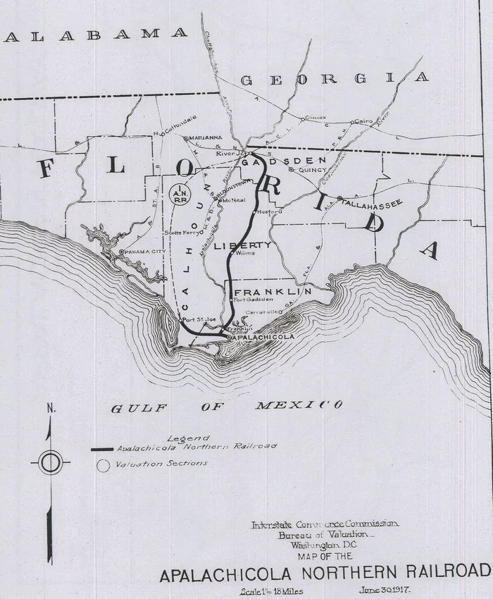
Sawmills, a railroad and Silk Stocking Street
Loggers cut the old-growth forest from 1880 into the early 1900s, according to the Friends of the Apalachicola National Forest. From 1898 to 1903, traffic on the Apalachicola River grew by almost 70 percent because of the lumber trade. In 1907 the Apalachicola Northern Railroad was finished, starting at River Junction in Gadsden County. Its 70 miles of track joined Florida's east-west rail lines.
That year Coe's Mill was renamed Hosford, after Senator Hosford, who did much to bring trains through Liberty County. One part of town was called Silk Stocking Street. FNAI says it got that name because the women married to the men there were the only ones able to afford silk stockings.
In the early 1900s the way to the county seat at Bristol ran through Telogia, the county's transportation hub. FNAI says the first graded road in the county linked Telogia and Bristol. In 1914 Dee M. Stoutamire built a sawmill at Blue Creek. It was one of many sawmills in the county at that time.
Sources: Friends of the Apalachicola National Forest (Florida State University Biology): Fact Sheet 1, ANF Basics (2006); Florida Natural Areas Inventory: ARROW History Regional Timeline, Apalachicola Region; Florida Natural Areas Inventory: ARROW, History: Liberty County
Next: Chapter 8, Torreya State Park and the Gregory House →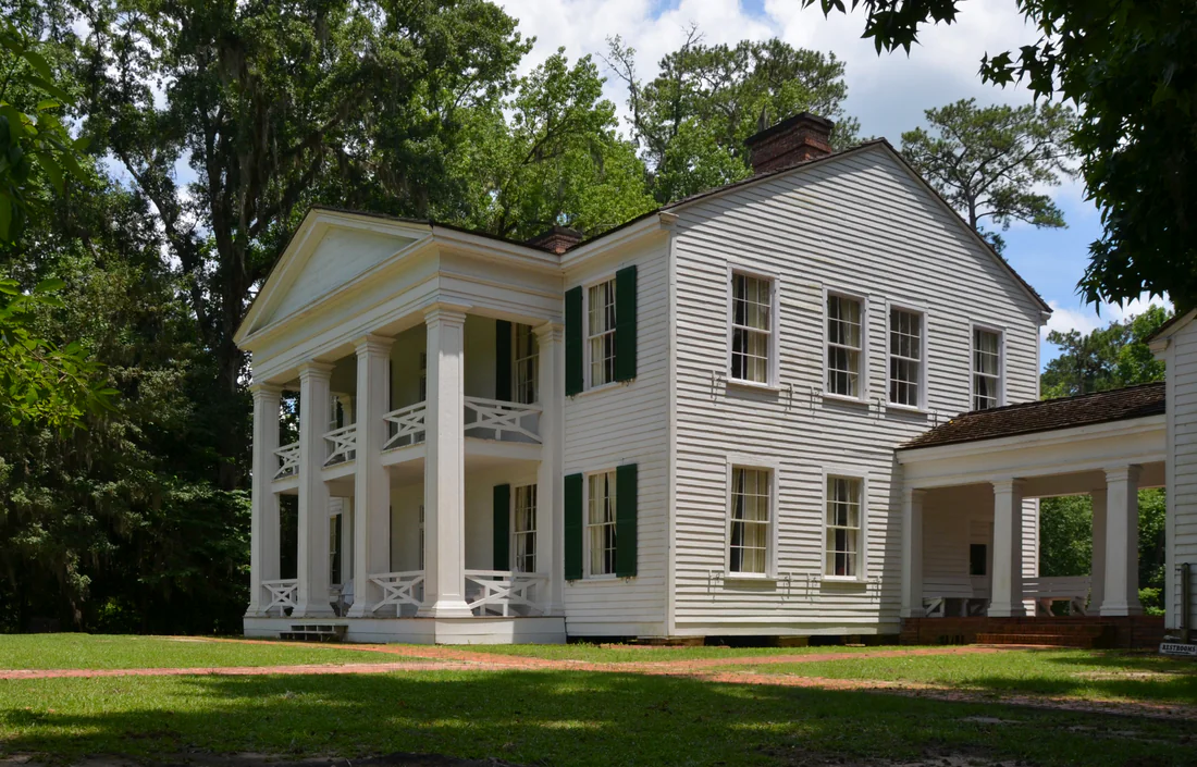
Torreya State Park and the Gregory House
Florida State Parks counts Torreya State Park among Florida's original state parks, built by the Civilian Conservation Corps during the Great Depression. FNAI says the park was set up in the mid-1930s to protect the rare torreya tree. The site was picked mainly for its history, including the Confederate gun pits and the cotton warehouse that once stood at Rock Bluff Landing. The WPA history notes that the Florida State Park Service was building the park at the time it was written. It gives the tree's local names as gopher wood and stinking cedar.
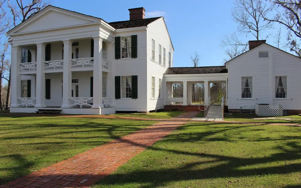
In 1935 the Gregory House, by then empty, was donated to the Civilian Conservation Corps, the park brochure says. A 1971 National Register form says instead that Blountstown's Neal Lumber Company gave the house, and that the Florida Board of Parks received it. Workers took the house apart, floated it across the river in sections and put it back together on Neal's Bluff inside the park. FNAI says the house made the trip by barge in 1935. The bluffs there rise over 150 feet above the water.
Sources: Florida State Parks: Torreya State Park, History; Florida Natural Areas Inventory: ARROW, History: Liberty County; Florida Memory, State Archives of Florida: History of Liberty County (WPA); Florida State Parks: Torreya State Park brochure; National Park Service, NPGallery: National Register of Historic Places Inventory, Nomination Form, Torreya State Park (Gregory House), 1971
Next: Chapter 9, A national forest, a new school and a bridge →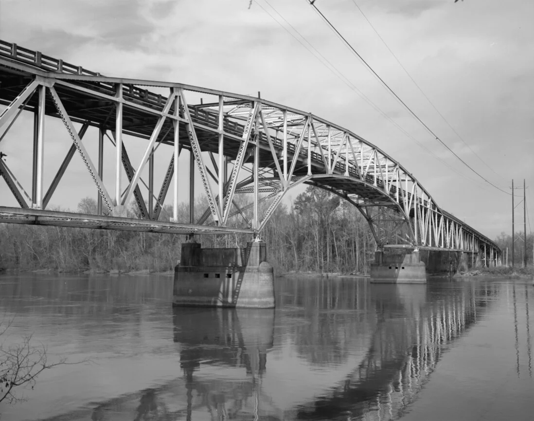
A national forest, a new school and a bridge
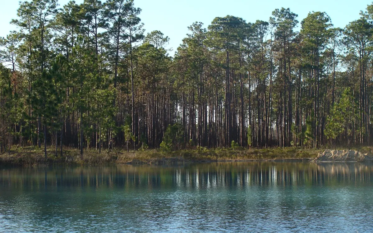
In 1936 President Franklin D. Roosevelt proclaimed the Apalachicola National Forest. A Forest Service handbook says the forest was set up mainly to steady a struggling community that had lived almost entirely off its timber. Its Wilma district lay mostly in Liberty County, and the district ranger was based at Wilma. The handbook also says a few small naval stores businesses, two or three of them, relied on the forest for timber. Across the Southeast, workers tapped many pines for their gum and distilled it into turpentine and rosin.
The Hosford School and its gymnasium were built in 1936. The federal WPA hired local craftsmen to build them, using pine from the area.
On October 20, 1938, more than 5,000 people came to the dedication of the Calhoun Bridge, which joined Bristol and Blountstown. The bridge opened up trade and travel between the two towns. A regional FNAI timeline gives the year as 1937.
Sources: NPS History eLibrary: U.S. Forest Service, Florida National Forests handbook, section 2; NPS History eLibrary: U.S. Forest Service, Florida National Forests handbook, Apalachicola National Forest section; Friends of the Apalachicola National Forest (Florida State University Biology): Fact Sheet 1, ANF Basics (2006); Florida Department of State: Secretary Byrd Announces the Designation of Hosford School and Gymnasium in the National Register of Historic Places (December 15, 2022); Florida Natural Areas Inventory: ARROW, History: Liberty County; Florida Natural Areas Inventory: ARROW History Regional Timeline, Apalachicola Region
Next: Chapter 10, Segregated schools and a disappearing tree →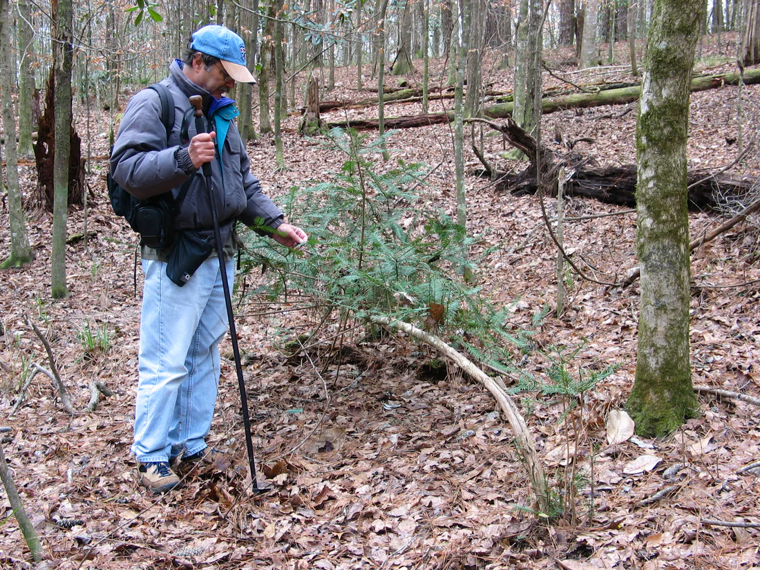
Segregated schools and a disappearing tree
Black students in Liberty County went to separate schools in the years of racial segregation. From 1936 until integration in the 1960s, the Hosford School taught white students, and the state calls it the only local public school. For many years, the state adds, the school and gym were the only places in Hosford, other than churches, big enough for large gatherings. After World War II they helped Hosford face a falling county population.
Starting in the 1950s, the number of wild torreya trees fell sharply. The park brochure blames a fungal blight. The Florida Park Service and the Atlanta Botanical Garden have worked together to grow new torreya trees.
Sources: Florida Department of State: Secretary Byrd Announces the Designation of Hosford School and Gymnasium in the National Register of Historic Places (December 15, 2022); Florida Natural Areas Inventory: ARROW, History: Liberty County; Florida State Parks: Torreya State Park brochure; Florida State Parks: The Rare Florida Torreya Tree
Next: Chapter 11, Since 1990: a holiday train, a park reopened and two National Register milestones →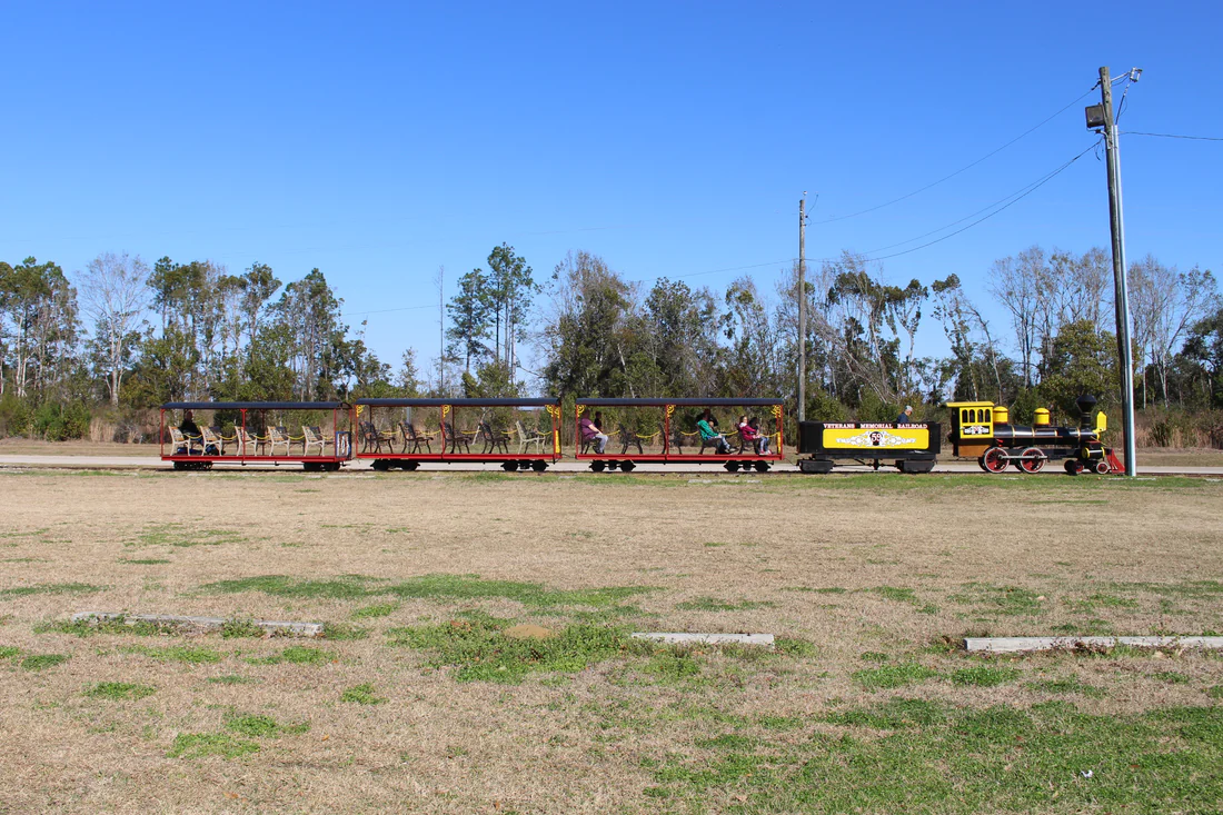
Since 1990: a holiday train, a park reopened and two National Register milestones
The Veterans Memorial Railroad runs through Veterans Memorial Park in Bristol. In June 2015 WTXL described its engine, Number 59, as a one-third-scale copy of a coal-fired steam locomotive from the late 1800s. The train ran on two-foot gauge track for more than a mile through the park. Organizers told WTXL in December 2015 that many volunteers had put in many hours building the park. That month riders on the railroad's Polar Bear Express saw thousands of Christmas lights and 17 holiday scenes along the track.
In December 2018, after weeks of cleanup and repair from Hurricane Michael, parts of Torreya State Park reopened for day use. In a bulletin dated February 28, 2019, the state marked the reopening of the park's campground.
On December 15, 2022, the Florida Department of State announced that the Hosford School and Gymnasium had been listed in the National Register of Historic Places. On November 22, 2024, the National Park Service approved a boundary increase for Torreya State Park in the National Register.
Sources: WTXL: Full steam ahead for upcoming Public Run Day (June 11, 2015); WTXL: Santa's workshop makes its way to Bristol (December 4, 2015); Florida Department of Environmental Protection: Torreya State Park Reopens (December 12, 2018); Florida Department of Environmental Protection: Torreya State Park Campground Reopens (February 28, 2019); Florida Department of State: Secretary Byrd Announces the Designation of Hosford School and Gymnasium in the National Register of Historic Places (December 15, 2022); National Park Service: Weekly List of Actions Taken on Properties, 11/22/2024 through 12/29/2024
Next: the whole story, in dates →The whole story, in dates
Native Americans build three dozen or more mounds above the river's floods.
A very small Swift Creek group lives at the Yon site.
Yon grows quickly into a Fort Walton center with its first mound.
Panfilo de Narvaez and his small army pass through the region.
Hernando de Soto leads his men through Florida and into Georgia.
The Spanish found four missions in the Apalachicola area.
Creek people led by Secoffee build towns in the area.
A British commander moves his troops and allies to Prospect Bluff.
A force under Colonel Duncan Clinch, with two gunboats, attacks the fort.
Andrew Jackson marches south on the river's east bank.
A new government road across north Florida meets the river at the future park.
The steamboat Fannie Fearn's begins trips between the Gulf and Columbus, Georgia.
Hardy Bryan Croom finds the Florida torreya tree.
Croom dies when the steamship Home is wrecked off Cape Hatteras.
Jason Gregory builds his house at Ocheesee Landing.
Liberty County is formed from part of Gadsden County.
James C. Evans pays more in taxes than anyone else in the county.
Rock Bluff is settled on the Apalachicola.
Bristol is settled and becomes the county seat.
Emmanuel Sykes founds Coe's Mill near Big Creek.
Loggers cut the old-growth forest.
Lake Mystic is founded.
A printing press arrives for the Liberty County Observer.
Lumber pushes river traffic up by almost 70 percent.
The way to Bristol runs through Telogia.
The Apalachicola Northern Railroad is finished.
Coe's Mill is renamed Hosford.
Dee M. Stoutamire builds a sawmill at Blue Creek.
The Gregory House is moved across the river to the park.
President Franklin D. Roosevelt proclaims the Apalachicola National Forest.
Local craftsmen build the Hosford School and its gymnasium.
More than 5,000 people attend the Calhoun Bridge dedication.
The number of wild torreya trees starts to fall sharply.
The Hosford School is integrated.
Polar Bear Express riders see 17 holiday scenes along the track.
Parts of Torreya State Park reopen after Hurricane Michael.
The Hosford School and Gymnasium's National Register listing is announced.
A boundary increase for Torreya State Park's listing is approved.
Where you can still see it
 01
 02
 03
Apalachicola National Forest
Goes with: A national forest, a new school and a bridge
Open the place page →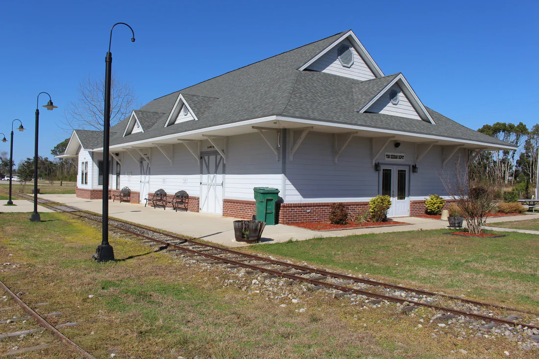 04
Veterans Memorial Railroad
Goes with: Since 1990: a holiday train, a park reopened and two National Register milestones
Open the place page →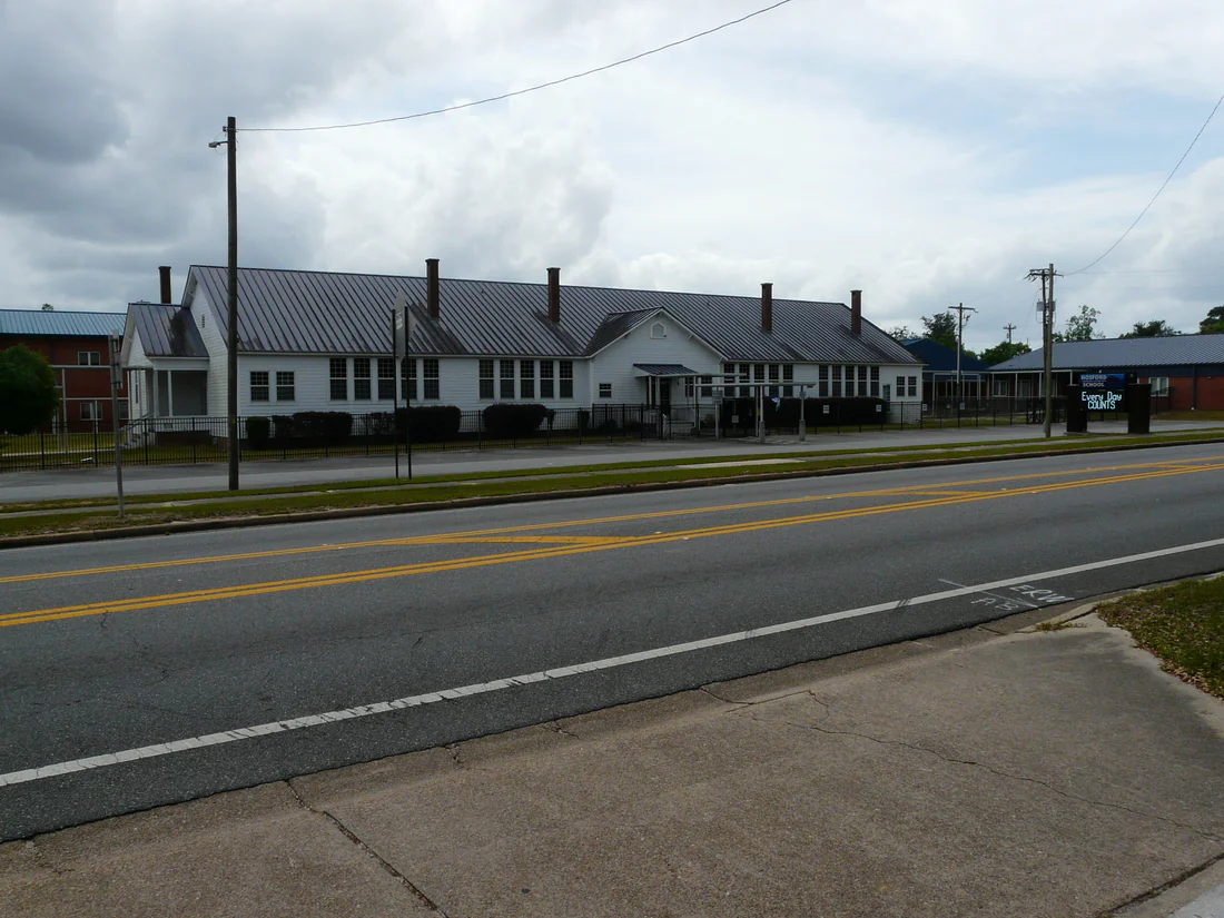 05
Hosford School and Gymnasium
Goes with: Since 1990: a holiday train, a park reopened and two National Register milestones
The state's announcement of the Hosford School and Gymnasium listing →Questions people ask
When was Liberty County created?
Liberty County was formed on December 15, 1855, from part of Gadsden County.
Chapter 4 →Where does the name Liberty County come from?
A University of South Florida map site says the name Liberty honors one of the ideals on which the United States was founded.
Chapter 4 →What is the county seat of Liberty County?
Bristol, settled in 1859, became the county seat.
Chapter 4 →What was the first village in Liberty County?
A WPA history says the county's first village was Riddleysville, beside the Apalachicola River.
Chapter 4 →Who discovered the Florida torreya tree?
Around 1835 Hardy Bryan Croom, a planter and botanist, found the Florida torreya tree in what is now Torreya State Park.
Chapter 3 →Where this comes from.
Last updated October 20, 2026.
- Florida Natural Areas Inventory: ARROW, History: Liberty County ↗ Read October 19, 2026
- Florida Natural Areas Inventory: ARROW History Regional Timeline, Apalachicola Region ↗ Read October 19, 2026
- University of South Florida, Florida Center for Instructional Technology: FL Maps, Liberty County ↗ Read October 19, 2026
- Florida Memory, State Archives of Florida: History of Liberty County (WPA) ↗ Read October 19, 2026
- University of South Florida Digital Commons: The Archaeology of Yon Mound and Village, Middle Apalachicola River Valley, Northwest Florida (Jeffrey Patrick Du Vernay, 2011) ↗ Read October 19, 2026
- National Park Service, NPGallery: Yon Mound and Village Site ↗ Read October 19, 2026
- Historical Marker Database: The Apalachicola River, A Florida Blueway (Chattahoochee River Landing Park marker) ↗ Read October 19, 2026
- Historical Marker Database: Torreya Tree (Florida Board of Parks and Historic Memorials marker F-46, 1961) ↗ Read October 19, 2026
- Florida State Parks: Torreya State Park ↗ Read October 19, 2026
- Florida State Parks: Torreya State Park, History ↗ Read October 19, 2026
- Florida State Parks: Torreya State Park brochure ↗ Read October 19, 2026
- Florida State Parks: The Rare Florida Torreya Tree ↗ Read October 19, 2026
- National Park Service, NPGallery: National Register of Historic Places Inventory, Nomination Form, Torreya State Park (Gregory House), 1971 ↗ Read October 19, 2026
- Friends of the Apalachicola National Forest (Florida State University Biology): Fact Sheet 1, ANF Basics (2006) ↗ Read October 19, 2026
- NPS History eLibrary: U.S. Forest Service, Florida National Forests handbook, section 2 ↗ Read October 19, 2026
- NPS History eLibrary: U.S. Forest Service, Florida National Forests handbook, Apalachicola National Forest section ↗ Read October 19, 2026
- Florida Department of State: Secretary Byrd Announces the Designation of Hosford School and Gymnasium in the National Register of Historic Places (December 15, 2022) ↗ Read October 19, 2026
- WTXL: Full steam ahead for upcoming Public Run Day (June 11, 2015) ↗ Read October 19, 2026
- WTXL: Santa's workshop makes its way to Bristol (December 4, 2015) ↗ Read October 19, 2026
- Florida Department of Environmental Protection: Torreya State Park Reopens (December 12, 2018) ↗ Read October 19, 2026
- National Park Service: Weekly List of Actions Taken on Properties, 11/22/2024 through 12/29/2024 ↗ Read October 19, 2026
- Florida Department of Environmental Protection: Torreya State Park Campground Reopens (February 28, 2019) ↗ Read October 19, 2026